On the morning of August 26, 2026, the mountains above Rasuwa, Nepal let go of something that had been building for a long time. A wall of water and debris tore down the Bhote Koshi and Trishuli river systems, sweeping through Syabrubesi, Timure, and the Rasuwagadhi border crossing before the sun had fully risen. By the time the water settled, entire sections of road were gone, entire houses and towns were swallowed, the Gyirong checkpoint linking Nepal to Tibet had been destroyed, and towns that generations of trekkers have passed through on their way to Langtang and Kailash were unrecognizable.
We've been watching this unfold for days now, the way most of Nepal's trekking community has been checking in with guides on the ground, refreshing government updates, and trying to separate rumor from fact. Here's where things actually stand.
How Nepal-Tibet Flash Flood Originated?
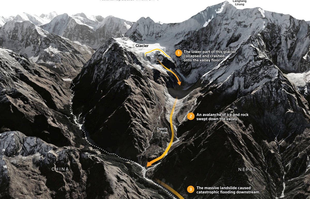
In the first confused hours after the flood, plenty of theories circulated: a Chinese dam failure, a deliberate river blockage, an earthquake. It's an understandable instinct when a disaster crosses an international border; people reach for the explanation that fits a narrative. But as satellite imagery came in over the following days, the picture became clearer and, in some ways, more sobering: the trigger appears to have been a glacier collapse on Langtang Lirung, right on the Northern Nepal-Tibet border, not anything originating from infrastructure in Tibet.
Shen Shiwei 沈诗伟/ X
Langtang Lirung is a 7,234-metre peak, one of the steepest mountain fronts anywhere in the Himalaya; it rises roughly 5,500 metres above the valley floor in only about 16 horizontal kilometers. Investigators believe part of the glacier and the mountainside beneath it gave way high on the peak, sending a million ton of ice, rock, and mud crashing into the Lhende Khola river below.
As it traveled downstream about 20 kilometers, first through Gyirong County on the Tibetan side, then back across the border toward Rasuwagadhi. It took about 7 minutes for the flood to hit the China-Nepal border. Researchers believe the river almost hit an average speed of about 150 kmph.
It picked up more sediment and water, growing into the surge that hit Nepal. The collapse was significant enough to register as a magnitude 5.2 tremor on seismometers worldwide, and researchers say a landslide-dammed lake formed at the collapse site briefly held back water before breaching and adding to the flood downstream.
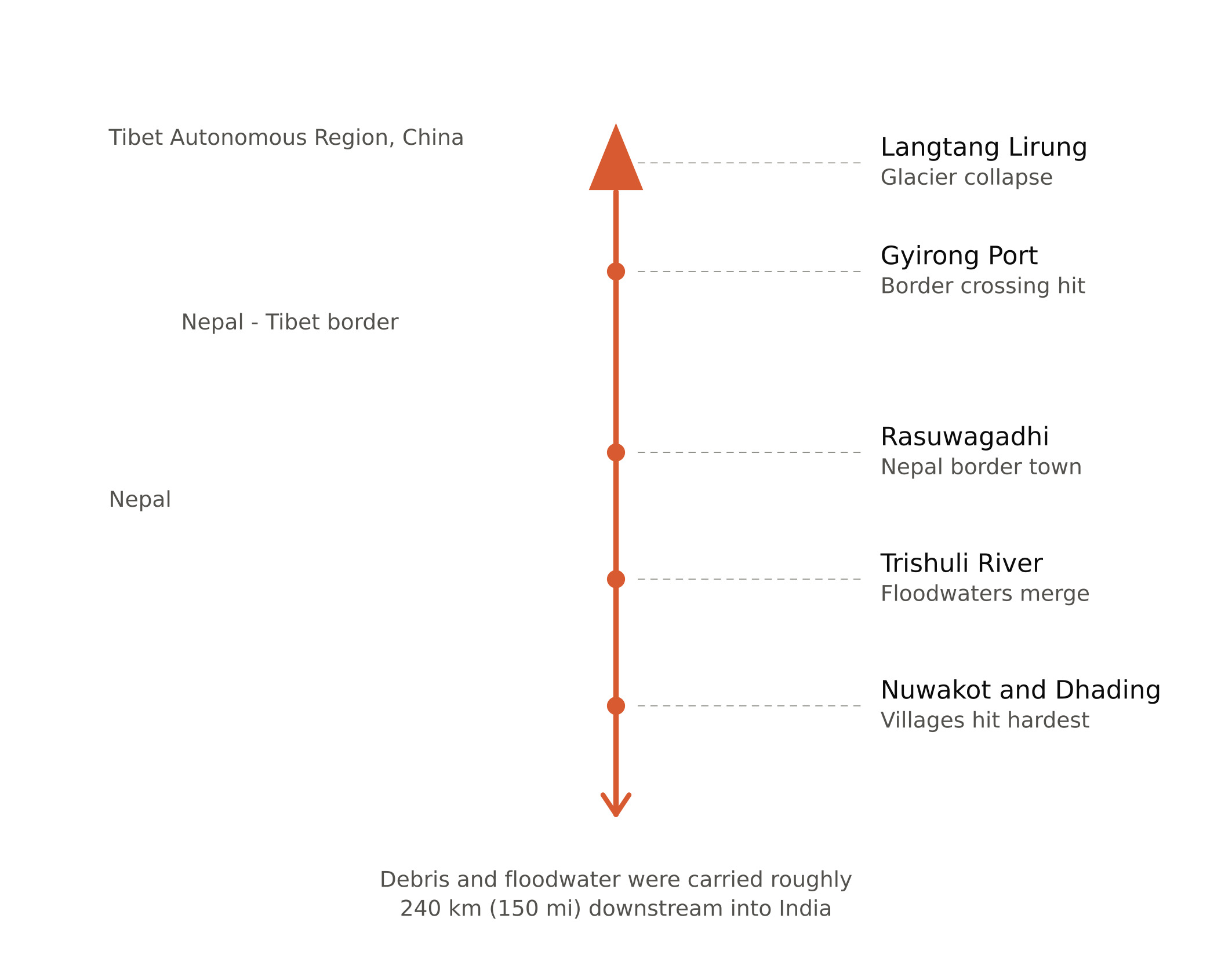
flood-path graphic, showing the route from Langtang Lirung down through Gyirong, Rasuwagadhi, and the Trishuli into IndiaCaption
The flood was so outrageous that the riverbed widened by at least 300m according to satellite images. The flood travelled more than 80km before it came to a calmer version. Originated from the Nepal-Tibet border, swept the villages of Betrawoti and Trishuli, affected Nuwakot and Dhading, and then, at the end, settled on the Indian side. A few days later, videos and photos of dead bodies floating on the Indian side of the river were circulating online.
This is part of a pattern locals and researchers have been watching for years. This is the third major glacial flood event to hit this same border corridor since 2021, following floods in 2021 and again in July 2025 that also destroyed river crossings and killed people in this exact stretch of Rasuwa. Glaciologists point to a specific mechanism behind the growing frequency: permafrost, the frozen ground that normally acts as glue holding steep slopes together, is thawing as the region warms, making the mountainsides above these valleys progressively less stable. Each event in this corridor has been larger than the last.
A History of Glacial Disasters in this Corridor
Glacial Disaster History In Langtang Corridor
Year
Event
Impact
2015
Earthquake-triggered collapse on Langtang Lirung
Over 350 people killed, Langtang village destroyed
2021
Glacial flood in the Melamchi/Rasuwa area
Major damage to river crossings and infrastructure
2025 (July)
Glacial flood along the same border corridor
Deaths reported, river crossings destroyed
2026 (August)
Langtang Lirung glacier collapse
Roughly 900 confirmed dead, 4,000+ missing in Nepal
The Toll
The numbers are still moving, and that's part of what makes this so hard to sit with. As of the most recent counts, Nepal has confirmed roughly 1130 deaths with over 4,700 people still missing, and the Tibetan side of the border has recorded additional deaths and missing persons. Floodwaters carried some victims as far as 150 miles downstream into India. UNICEF has reported that children are among the confirmed dead and that thousands of families in Rasuwa, Nuwakot, and Dhading now face displacement, with several health facilities in the region damaged badly enough to disrupt care.
Langtang Valley is one of Nepal's most popular trekking destinations, and Syabrubesi is the gateway town where nearly every trekker heading into the valley spends at least a night before or after their trek. That's part of why so many foreign nationals ended up caught up in this disaster — hundreds of tourists, Nepali and foreign alike, were reported unaccounted for in the days after the flood, many of them travelers who had been passing through Syabrubesi or heading toward the Tibet border for Kailash pilgrimages when the water hit.
There is one small mercy in the timing. August falls outside Nepal's peak trekking season; the autumn rush doesn't really begin until late September and October, so the number of local and foreign trekkers actually on the trail through Syabrubesi at the moment of the flood was far lower than it would have been just a few weeks later. It's a grim thing to call fortunate, but had this happened during peak season, the toll among trekkers alone could have been dramatically higher.
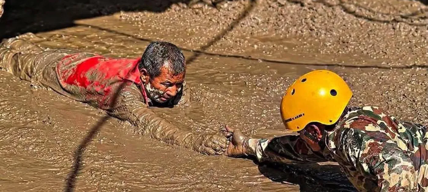
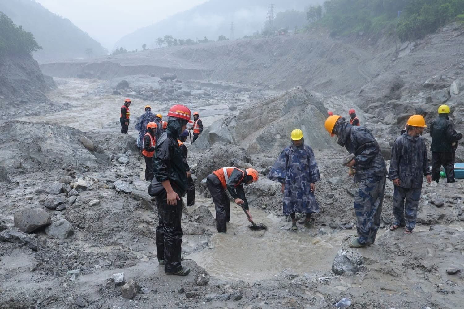
Search and rescue operations have continued daily since, though unstable terrain, damaged roads, and ongoing monsoon rain have made the work slow and dangerous.
We're not going to pretend this is just a logistics story. Real families are living through the worst days of their lives right now, and if you're reading this while planning a trip to our part of the world, we think it's worth pausing on that before getting into the practical details below.
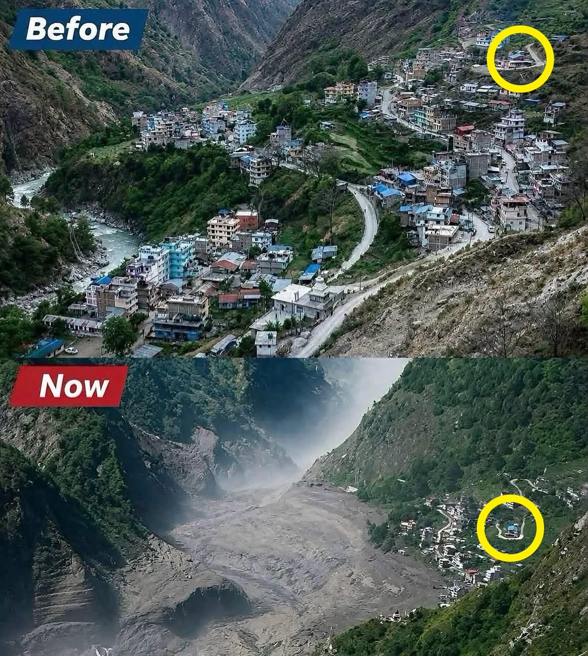
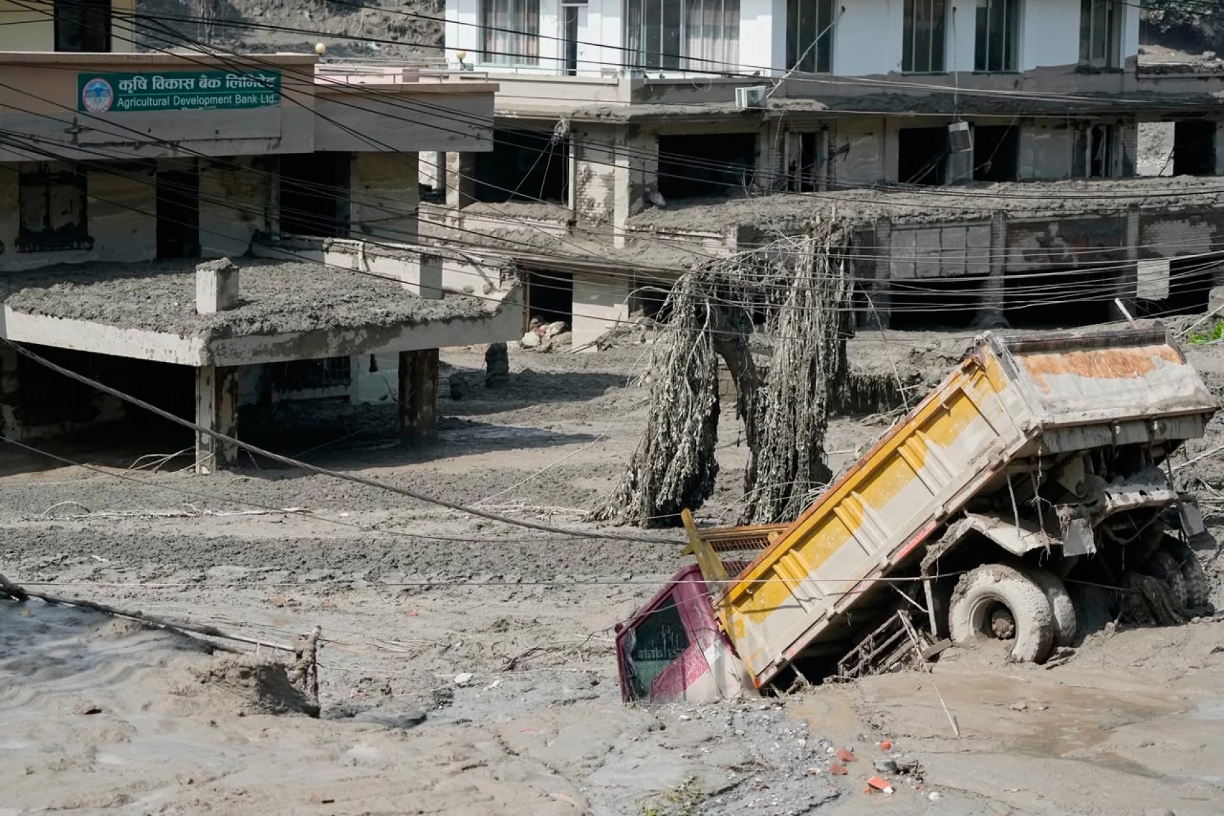
Syabrubesi before and after, notice the yellow mark
Timeline of Events
August 26: In the early morning hours, a section of Langtang Lirung's glacier and mountainside collapses, sending debris crashing into the Lhende Khola. The resulting surge travels south through Gyirong County in Tibet before crossing back into Nepal, destroying the Gyirong/Rasuwagadhi border checkpoint and tearing through Syabrubesi, Timure, and surrounding villages. More than 2500 buildings were destroyed. Emergency response begins within hours as the scale of the damage becomes clear.
August 27: Nepal's government mobilizes security forces to the affected districts. Prime Minister Balen Shah visits Nuwakot to assess the damage as casualty figures climb sharply. Early reports place the toll at over 150 confirmed dead with hundreds more unaccounted for a number that would grow substantially over the following days.
August 28: Chinese rescue teams reach the border area from the Tibetan side, describing the destruction at the former checkpoint as near-total. Search and rescue operations expand along the Trishuli corridor, complicated by unstable terrain and continued monsoon rain.
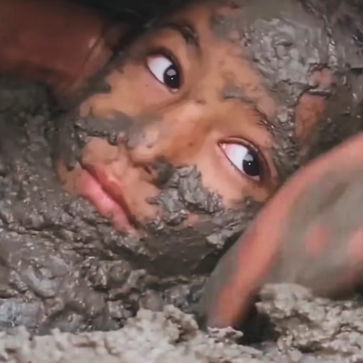
Small Nepali girl rescued alive after being trapped for 60+ hours
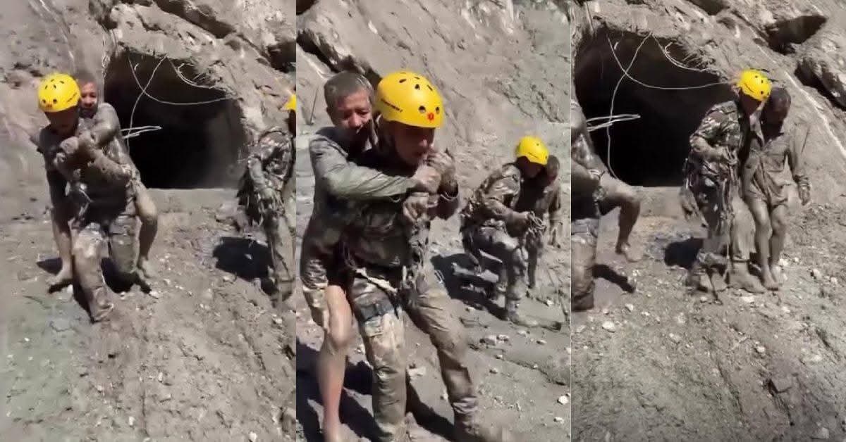
August 29–30: India dispatches relief flights carrying supplies and offers specialized tunnel-rescue support for workers trapped in damaged hydropower infrastructure along the Trishuli. International organizations, including UNICEF and the Nepal Red Cross, begin coordinated relief operations in Rasuwa, Nuwakot, and Dhading.
Early September (current): Search and recovery operations continue daily. The confirmed death toll in Nepal has climbed to roughly 1100, with over 4,700 people still listed as missing. Rebuilding of the Rasuwagadhi border crossing and the Trishuli–Syabrubesi road corridor is expected to take months.
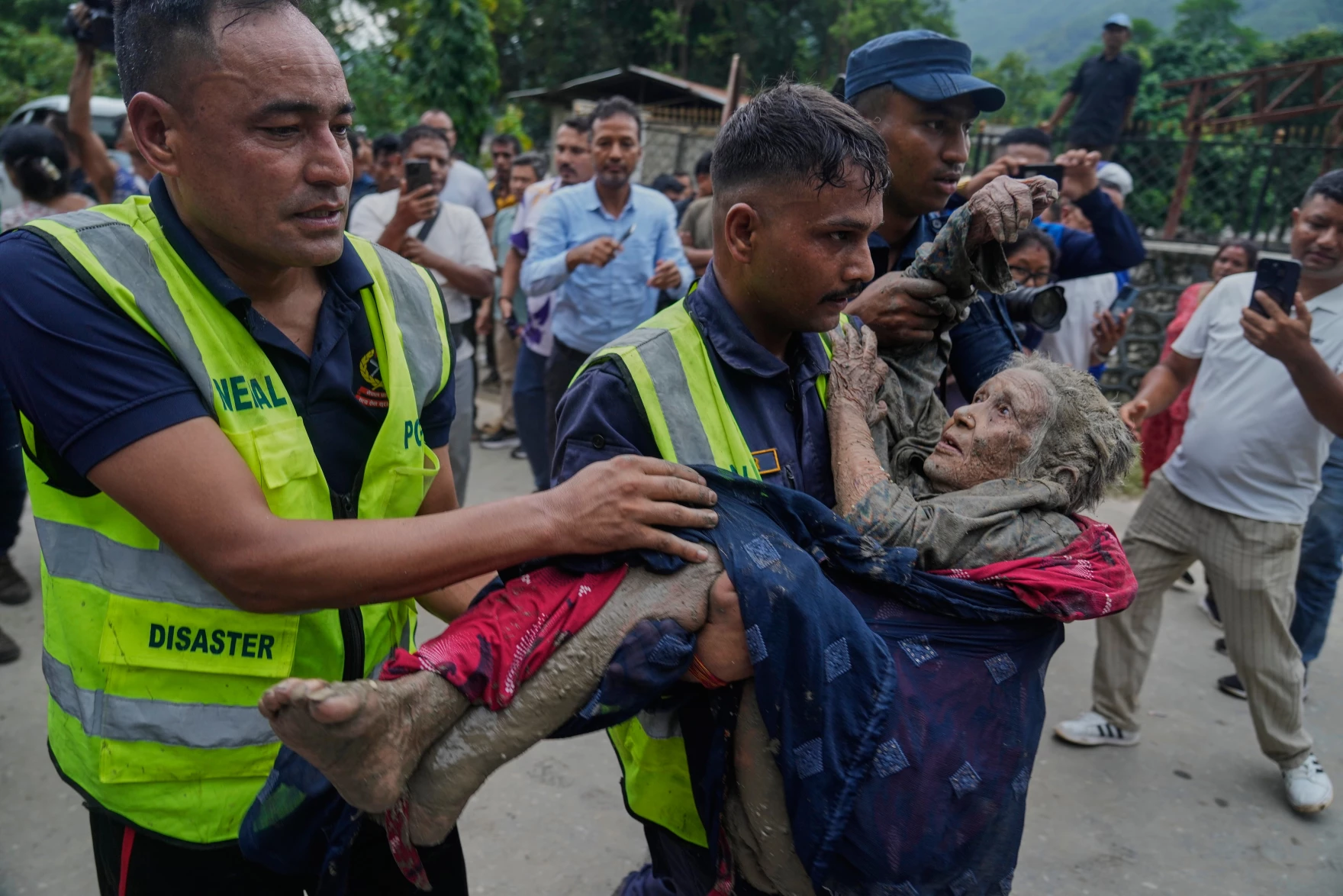
Photo: Niranjan Shrestha/AP
How the Response is Being Coordinated
Nepal has deployed more than 10,000 security personnel, army, armed police, and civil police to the affected districts, and more than 3,700 people have been rescued so far. The government has designated 15 municipalities across Rasuwa, Nuwakot, and Dhading as disaster-affected zones for an initial three-month period, which unlocks emergency funding and relief coordination at the local level.
On the international side, the response has moved faster than in past disasters of this scale. China's rescue teams reached the border from the Tibetan side within roughly 48 hours, focusing on the destroyed Gyirong checkpoint and stranded travelers. India sent relief flights carrying an estimated 60 tons of supplies and offered specialized tunnel-rescue teams to help reach workers trapped in damaged hydropower infrastructure along the Trishuli River. The World Health Organization, Nepal Red Cross Society, CARE, and Direct Relief are all running parallel relief operations, focused on emergency medical care, clean water, and temporary shelter for displaced families.
Events like this one are known as GLOFs (Glacial Lake Outburst floods), and they're becoming one of the defining hazards of a warming Himalaya. As glaciers melt and retreat, they often leave behind lakes dammed by loose rock and ice debris, sometimes sitting directly beneath steep, unstable slopes. When a chunk of glacier or mountainside collapses into one of these lakes or, as investigators believe happened at Langtang Lirung, when the collapse itself carries enough ice and rock to trigger a similar surge without a pre-existing lake.The result is a sudden, massive release of water and debris that can travel dozens of kilometers within hours.
What makes this particularly dangerous in a corridor like Rasuwa is the terrain itself: steep, narrow valleys concentrate the water's force rather than letting it spread out, which is part of why a single glacial event can devastate towns many kilometers downstream. Researchers who study the Himalayan cryosphere have flagged this region specifically as one where warming has made this kind of event more frequent, this is the third major glacial flood to hit this same corridor since 2021.
What's Closed and What Isn't
Here's where a lot of headlines have gotten ahead of the facts. The flood hit one specific river corridor, not the whole country, and the damage is more contained than the scale of the tragedy might suggest.
Affected:
The road corridor from Trishuli through Betrabati to Syabrubesi, the standard gateway to Langtang, has sustained serious damage and is currently unsafe or restricted.
Syabrubesi itself took heavy structural damage.
The Rasuwagadhi–Kerung border crossing, the main overland route to Tibet and the primary corridor for Kailash Mansarovar pilgrimages, is closed and will likely stay that way for months while it's rebuilt.
Four hydropower plants in the district were damaged, and over a kilometer of road across multiple sites was destroyed.
Not affected:
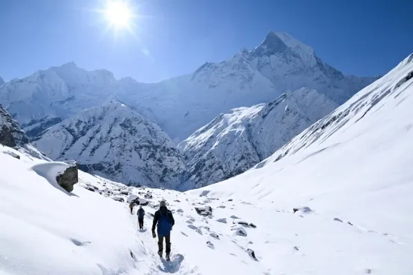
The Langtang Valley trail itself sits in a different drainage, the Langtang Khola, not the Bhote Koshi that flooded, and the high trail was not in the flood's direct path. The problem right now is reaching the trailhead safely, not the trail itself.
Everest, Annapurna, Manaslu, Kanchenjunga, and Makalu Base Camp treks are all operating normally with no reported disruption. The one hiccup on the Annapurna side has been a brief closure on the Kathmandu–Pokhara highway, expected to clear quickly.
For Langtang specifically, there is a longer alternative approach that avoids the damaged corridor entirely,routing on foot via Sundarijal, Chisapani, and Gosaikunda rather than driving in through Trishuli. It adds days to an itinerary, so it's not a like-for-like substitute, but it's an option worth discussing with your operator if Langtang is non-negotiable for your trip.
The Unfairness of Natural Disasters in Nepal
There's a bitter irony that a lot of Nepalis feel deeply in moments like this. Nepal contributes an estimated 0.04% of the world's CO2 emissions and roughly 0.1% of global greenhouse gases.
A footprint so small it barely registers on any global chart, yet it's Nepal's mountains that are collapsing, Nepal's glaciers that are melting, and Nepal's people who are burying their dead. This isn't a country that has been careless with the planet, either: Nepal grew its forest cover from 45.33% of its land area in 2019 to 46.08% in 2022, and by 2026 electric vehicles made up roughly 73% of new car sales here, one of the highest EV adoption rates anywhere in the world. Nepal has done, by almost any measure, more than its fair share. And still, it's paying the price for emissions produced almost entirely elsewhere.
It's hard not to feel that weight here, watching a country that contributes so little to the problem absorb so much of its consequences. If there's one thing worth asking of the countries that produce the overwhelming majority of global emissions, it's this: take the warming seriously, cut emissions meaningfully, and recognize that the cost of inaction isn't abstract, it's measured in villages like Timure and Syabrubesi, and in the thousands of families in Rasuwa, Nuwakot, and Dhading who had no hand in causing this and no way to stop it.
Final Words from Hiking Bees Team
Langtang holds a very special place in our hearts. We've spent years running treks through Syabrubesi, and few of our guides come from that region: for us, this isn't a place on a map, it's family. That's part of what makes this so devastating, both personally and as a company. We didn't just build routes through that corridor; we built relationships there, over years, with people who welcomed our trekkers into their homes and their lives.
The Langtang-Rasuwa region has given so much to Nepal, it introduced countless local and foreign trekkers to some of the most breathtaking landscapes in the Himalaya, and it's done more than its share to put Nepali trekking on the map. Watching that same region go through something like this is heartbreaking, and we know we're not alone in feeling it. Right now, our thoughts are with everyone in Rasuwa, Nuwakot, and Dhading especially the guides, lodge owners, and families we've come to know over the years and we'll be doing what we can, in whatever way we're able, to support the region that's given us so much.
Frequently asked questions
Is Kathmandu safe to visit right now?
Yes. The capital itself was not affected by the flood, and flights in and out of Kathmandu are operating normally.
Can I still travel to Nepal for trekking?
Yes, with one significant exception: the Rasuwa corridor, including the standard road route to Langtang and the Rasuwagadhi border crossing to Tibet. Everest, Annapurna, Manaslu, Kanchenjunga, and Makalu Base Camp routes are all operating as normal.
What about my Everest Base Camp or Annapurna Circuit trek specifically?
Both are unaffected and running on schedule. Neither route passes through the flood-damaged corridor.
Is the Langtang Valley trek cancelled?
Not permanently, but the standard access road through Syabrubesi is currently damaged. There's a longer alternate route via Sundarijal, Chisapani, and Gosaikunda, though it adds several days to the itinerary. We'd recommend postponing rather than attempting the standard route until road access is restored.
How can I check on someone who was trekking in the area when the flood hit?
Contact your embassy's consular services in Kathmandu first, most have set up dedicated channels for this disaster. If they were traveling with a registered operator, that operator's local office is often the fastest source of information.
How can I help?
Donations to the Nepal Red Cross Society go directly toward relief efforts in the affected districts. If you're not in a position to travel or donate, sharing accurate, up-to-date information (rather than unverified claims) also matters, a lot of misinformation circulated in the first days after the flood.